An Irish navigation gyroscope will guide a European space mission carrying four Earth observation satellites and another to measure global greenhouse gas distribution, set to launch from French Guiana early tomorrow morning.
The five satellites will be carried into space on Vega-C, a 35-metre tall, 210-tonne expendable European rocket which first launched in July 2022, in a collaborative mission between Airbus and CNES, the French space agency.
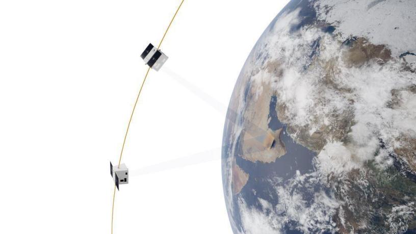
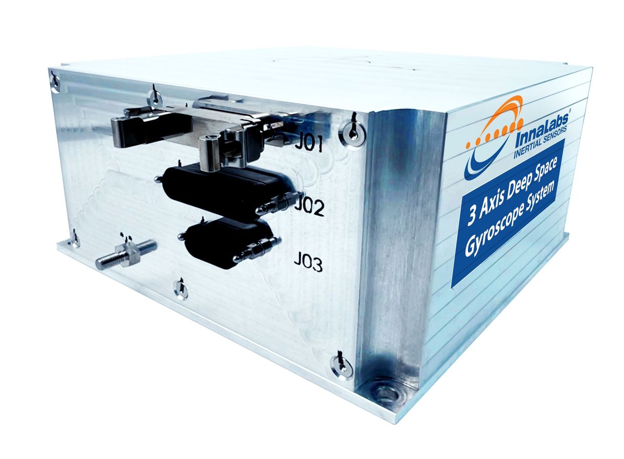
The Irish input to the mission is a gyroscope that measures rotation in space. The device, created by Innalabs in Dublin, is designed so that satellites, once in space, point correctly towards a precise location or feature on the ground.
“With over five million hours of our technology operating in space without a single failure, we’re confident in our capabilities –but space is unforgiving, and we never take that lightly,” Alberto Torasso, vice-president of space programs at Innalabs, said.
Blanchardstown-based Innalabs is one of a growing number of space companies in Ireland.
“Our involvement in high-profile missions absolutely helps shine a spotlight on the strength and potential of the Irish space sector –both here in Europe and further afield,” CEO John O’Leary said.
In 2020 the company signed the contract to deliver the gyroscope for tomorrow’s mission, after convincing satellite makers and the European Space Agency (ESA) of the quality of their gyroscope technology.
Innalabs has all the different skillsets needed to put such a complex device together, its head of marketing and communications Peter Nicholson said.
These include design engineers; operators that can perform complex assembly and soldering according to European space standards; and people that make sure the processes and parts are all up to the right standards.
The Innalabs gyroscope navigation system, the company said, provides its customers with radiation-tolerant, high-precision inertial navigation.
Inertial navigation is a system that uses sensors to determine an object’s position, orientation and velocity without relying on GPS or other outside reference points, constantly tracking any acceleration or rotation changes.
The collection of four Airbus-built satellites, each weighing 300kg, referred to as CO3D, or “Constellation Optique 3D”, are designed for high-resolution 3D mapping of the Earth. They will be launched into low orbit and their images will help environmental monitoring, urban planning and disaster response.
The other passenger is MicroCarb, a polar-orbiting satellite developed by CNES. This has been designed to measure global atmospheric CO2 and is a critical part of European efforts to monitor the climate impact of this greenhouse gas.
“We take great pride in watching our technology head into space, and whenever possible, we gather at our facilities to witness these special moments together,” Mr Nicholson said.
“The real celebration will come the next day. We’ll be rolling out the big screen in the canteen to rewatch the launch and celebrate another proud milestone as a team.”
You can follow the launch live on the European Space Agency website from 2.40am Saturday, Irish time.
